Elite's team of dedicated engineers and surveyors are capable of producing a range of detailed surveys such as :
- Topographical surveys
- Underground utility mapping
- CCTV drainage surveys
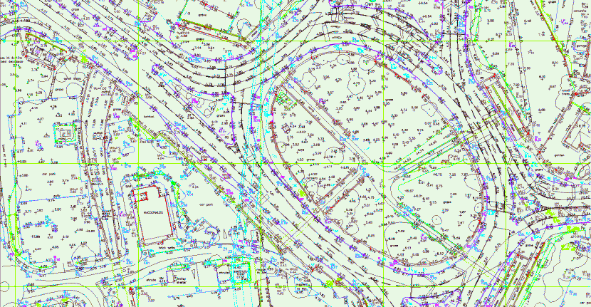
Topographical surveys or land surveys are detailed accurate plan drawings identifying both natural and man-made features within a specified area. The plan will show all features such as buildings, boundaries, services covers and site levels. Normally presented digitally in various 2D & 3D CAD formats, we are also able to provide scaled paper copies.
Elite's underground utility mapping enables buried services and utilities to be detected and mapped. Our surveys can show full horizontal and vertical (depth of cover) positioning on all detected buried utilities and anomalies, including plastic, fibre-optic and clay drainage pipes. This means we are able to detect, locate and map electricity cables, gas, water and communications including fibre-optic. Underground utility mapping is necessary for the safety of the workforce and public. It minimises project delays and utility damage – saving delay and damage costs.
A drain survey alerts you to any potential problems, such as structural issues (fractures or collapse), root ingress or blockages. Elite's CCTV surveys are suitable for any type of property — residential, commercial, industrial or infrastructure such as roads, utility, etc. Our services may well help you to avert a drainage disaster in the future.
Using modern technology we will provide you with the most cost effective solution, delivering your information quickly. We will work with you to tailor a specification and proposal that suits your requirements. Depending on the size and type of your project we can provide the information important to you. Our aim is to provide you with exactly what you need, delivered when you want it.